
Urlătoarea Waterfall: the walk from Bușteni
The walk to Urlătoarea Waterfall is one of the easier outings from Bușteni. It’s still a mountain path, though, with roots, uneven ground and slippery stretches after rain or snow.
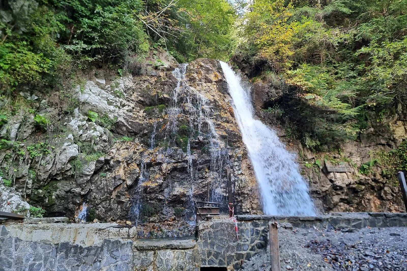
The route from Bușteni
The usual approach begins on the Bușteni side near the cable-car area, then follows a red-dot-marked forest path towards Cascada Urlătoarea. Once past the busy streets, the route climbs gradually among trees, roots and uneven ground.
The Bucegi Natural Park lists a Bușteni–Urlătoarea thematic trail of 3.37 km with a published time of 1 hour 40 minutes and an easy-to-moderate classification. That figure describes the park’s listed route, not necessarily every walk measured from your hotel or the Bușteni railway station. Add time for reaching the trailhead and for returning.
It is a pleasant choice on a dry day with good visibility. It becomes less straightforward when the track is icy, waterlogged or covered in compacted snow.
Alternative starting point: Poiana Țapului
Another approach runs from the Poiana Țapului side. Older regional hiking documentation lists a blue-dot route from Poiana Țapului to the waterfall. Do not merge the markings from different approaches into one fictional route.
If your group has children or is inexperienced, choose one trailhead and follow its marked path rather than cutting across unfamiliar forest tracks. The path used to reach the waterfall also determines your walking distance back to transport.
The waterfall is not a high-altitude summit. That does not remove the need to check weather, footing or wildlife guidance.
What the walk feels like
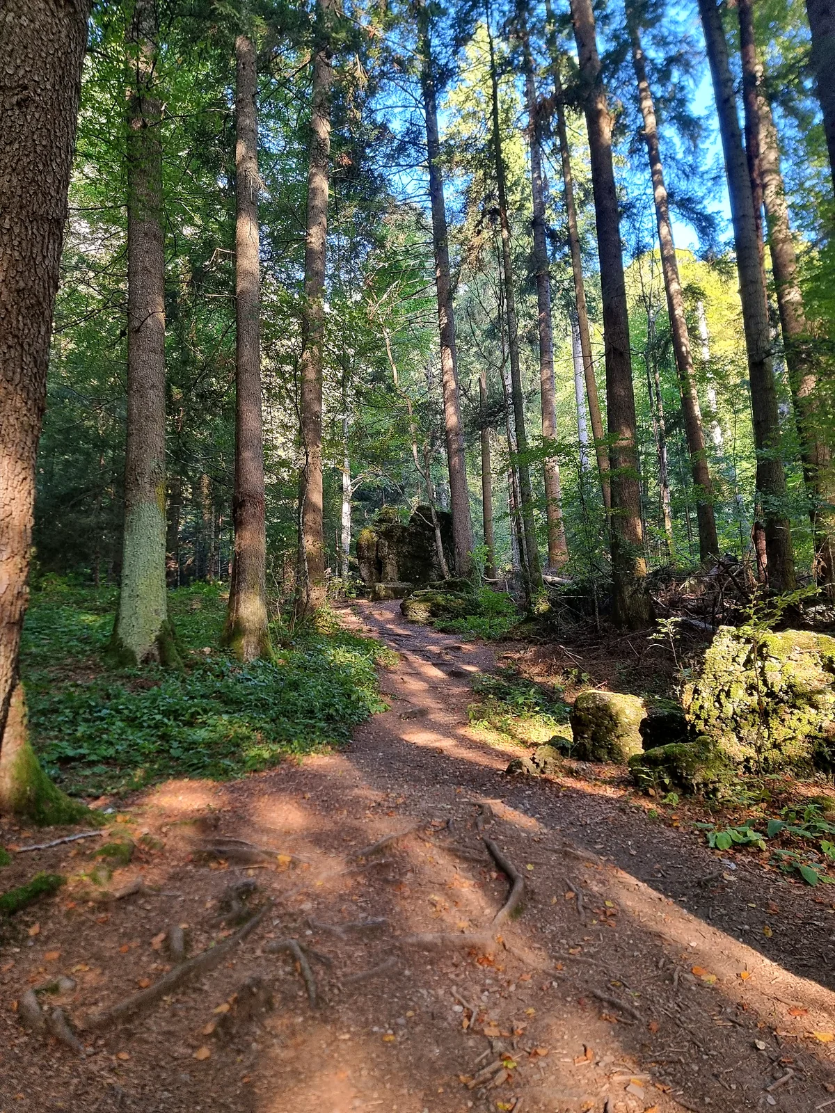
Most of the experience is the forest, not the final photograph. The path passes through the lower Bucegi woods and climbs in stages. Expect natural surfaces, exposed roots and wet stone in places. You can often hear the waterfall before reaching the viewing area.
Urlătoarea is known for its falling water and striking sound. Conditions change with rainfall and season: high flow can make nearby surfaces slippery; freezing temperatures can turn spray into ice.
Footwear, timing and safety
- Wear grippy walking shoes or light hiking boots, not smooth-soled city shoes.
- Carry water, a layer for changing temperatures and a charged phone.
- Start early enough to return in daylight; in late autumn darkness arrives quickly.
- Do not enter the forest during a storm or when local authorities advise avoiding trails.
- Follow Bucegi Natural Park wildlife guidance; never feed animals or leave food waste.
In a mountain emergency call 112. Check current park advice before your walk; a generic “easy” label is not a year-round safety guarantee.
Reaching the trailhead without a car
Bușteni has a railway station on the Bucharest–Brașov line. From there, allow additional time for the town approach to the starting area. The distance depends on where you begin walking; a train timetable and a local street map are both useful.
For a full day, combine the waterfall with a low-key visit to the town, not with a rushed high-mountain cable-car trip. See the Bușteni guide, or travel using our car-free planning page.
Should you choose this or a bigger Bucegi hike?
Urlătoarea is a better fit for a short, lower-altitude forest excursion. The Jepii Mici route is a very different proposition: steeper, more demanding and unsuitable as an improvised beginner alternative. If mountain conditions are doubtful, keep your plans low.
For families, see Prahova Valley with kids. For poor weather, use the planned Bușteni rain guide once published, or stay with indoor attractions such as Cantacuzino Castle if operating.
How long should you allow for the walk?
The natural park’s thematic-trail listing gives the Bușteni–Urlătoarea route as 3.37 kilometres and 1 hour 40 minutes, with an easy-to-average classification. That is a useful reference, but its exact route definition matters: someone who starts at the railway station, walks to the forest entrance, stops frequently for photographs and later returns along the same trail will spend substantially longer out than the headline trail figure.
A relaxed visit should include time to locate the trailhead, walk at the pace of the slowest member of the group, stop safely at the waterfall and retrace the route. A family with young children may need extra breaks, while strong walkers might move faster on a dry path. Plan for the conditions you have, not for the pace in somebody else’s fitness app. A single quoted duration cannot replace a real turnaround time.
The easiest way to avoid rushing is to treat this as the day’s main walk, particularly outside summer. If you hope to combine it with a castle visit or a restaurant reservation, put the fixed appointment later in the day and allow a weather margin. Forest terrain becomes much harder to judge once daylight fades, even when it is only a short distance from town.
Following trail markings without second-guessing them
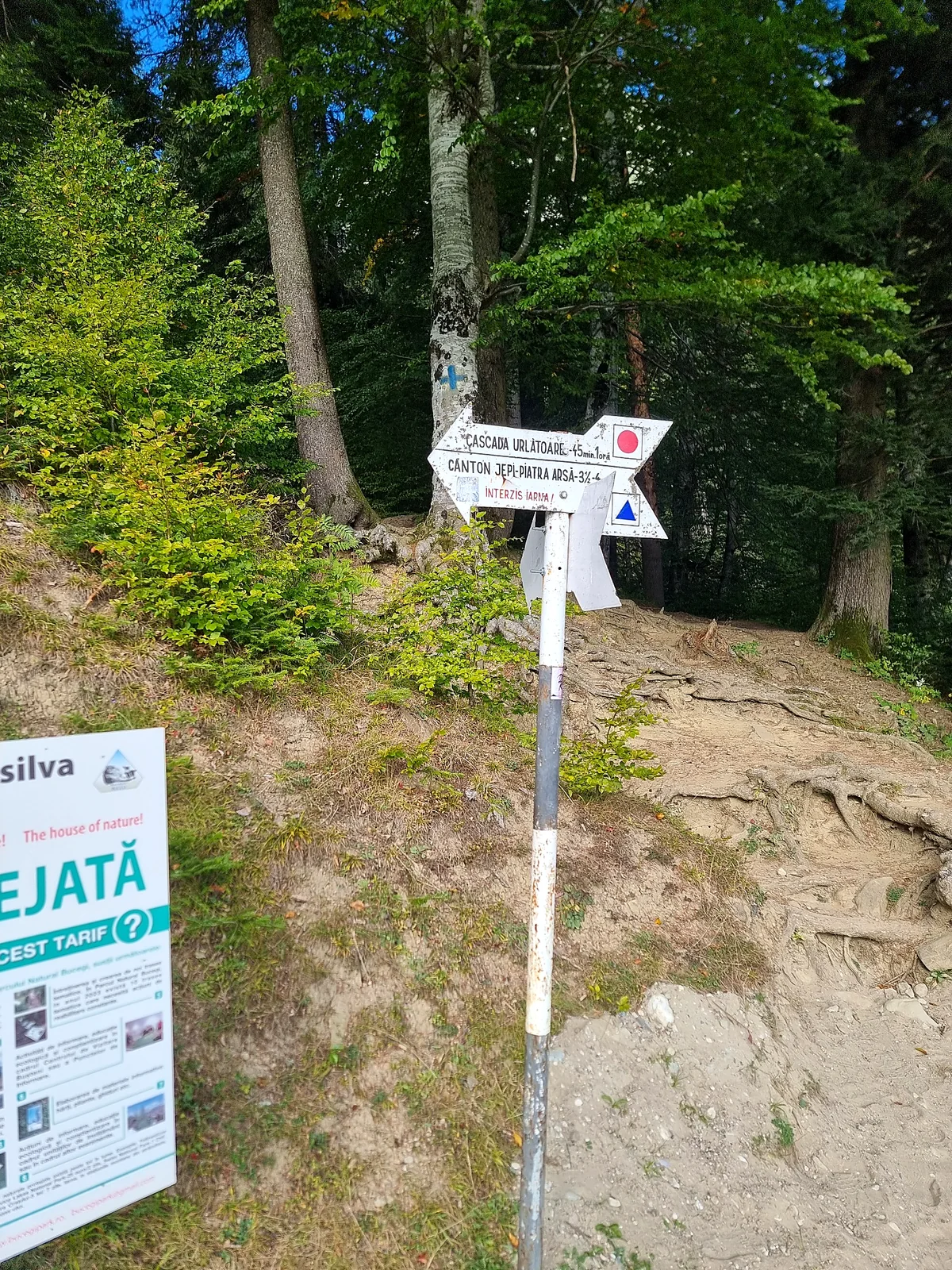
Romania’s mountain routes use familiar painted symbols: a coloured stripe, dot or cross within a white background. The path usually described from Bușteni towards Urlătoarea follows a red-dot marking. The Poiana Țapului approach has been described with a different marking, which is a reminder not to copy half of one trail description into another. Check the current signboard at the starting point and use the complete route name rather than following an isolated coloured mark.
Where a path forks, stop for a moment and look for the next marker. A wider track, a line of footprints or a shortcut visible on a phone map does not guarantee the correct route. If marking becomes difficult to follow, turning back on the known trail is safer than trying to reconnect through unmarked forest. Downloading a map while on hotel Wi-Fi is useful, but it should complement signs and current park guidance.
The park provides route information and GPX resources for its thematic trails. Check that the file really matches your planned start, the direction of travel and the date of publication. Do not confuse the short forest approach with the much steeper Bucegi routes leading towards the Babele plateau. Those are different mountain days, with very different equipment and weather requirements.
Rain, ice and the seasons
In summer the shade of the forest can make the route pleasant, but a thunderstorm changes matters quickly. Water runs across roots and stones, and the waterfall area may become slippery as spray spreads. Do not shelter under an isolated tree during lightning or continue towards the cascade because you are “almost there”. If the forecast is uncertain, choose a shorter town walk and keep this trail for a better morning.
In autumn the main challenge can be wet leaves hiding roots, mud and early darkness. A route that feels easy on a dry June afternoon can require much more care in November. Winter is a separate judgement: ice on the path and around the waterfall can make a normally approachable excursion unsafe without appropriate equipment and local advice. Published “easy” ratings do not mean the route is suitable in every month.
Spring can bring higher waterfall flow and a strong visual reward, but snowmelt and persistent moisture make some surfaces treacherous. Never step off an established viewpoint to stand closer to the torrent. The aim is to enjoy the waterfall, not to reach the lowest possible rock. Ask the local mountain rescue service or park staff about closures and dangerous stretches when conditions are unusual.
Is the waterfall walk suitable for children?
Older children accustomed to forest walks may enjoy the route in dry conditions. For a very small child, the answer depends on the adult’s experience, the current ground conditions and how comfortably the child walks on uneven paths. There are natural roots, changes in gradient and slippery surfaces, so this is not a reliable stroller outing. Shoes suitable for a shopping centre are also a poor choice when the track is damp.
Keep children within sight and explain before the walk that the waterfall area is for watching from a safe distance. Slipping on wet rock is an obvious hazard, but smaller risks such as straying towards a steep bank or collecting stones beside flowing water also matter. Pack an extra warm layer and snacks, then set a definite point at which you will turn around if anyone becomes tired.
For travellers with limited mobility, do not assume the park’s easy-to-average description implies wheelchair access. The terrain is a natural forest path and conditions vary. Consider a viewpoint or cultural attraction in Bușteni instead, and ask local services about the most accessible alternatives. Our family guide has further ideas for a slower day in the valley.
Wildlife and the natural park
This walk takes place in the lower reaches of the Bucegi mountain environment, not a fenced municipal park. The region is home to wildlife, and a wildlife encounter is possible even close to the edge of town. Stay on marked trails, do not feed animals and do not leave sandwich wrappers or other food waste behind. If you notice wildlife on or near the path, keep a respectful distance and follow official local guidance rather than moving closer for a photograph.
The same principle applies to plants and streams. Leave vegetation where it grows and resist carving names into trees or moving rocks to build a photo spot. A heavily visited waterfall can still feel wild if people treat its surroundings carefully. Bring rubbish back to town rather than assuming there will be bins deep in the forest.
Romania’s mountain rescue organisation recommends checking route conditions, weather, marking and your group’s capabilities before setting off. If you need help in an emergency, contact 112 and be prepared to describe your starting point, direction of travel and the last visible trail marker. Sharing your intended walk and approximate return time with someone at your accommodation is a simple precaution.
Trail information and useful links
Check the park’s trail information and the weather forecast before you set out.