
Bucegi · Baiului · Piatra Mare
Hiking in Prahova Valley: trails in Bucegi, Baiului & Piatra Mare
Hiking in Prahova Valley ranges from short forest walks above Bușteni to long ascents toward Omu Peak and exposed routes on the Bucegi plateau. Use this page to compare route time, difficulty, trail marking and starting area, then check mountain-rescue warnings, weather and the real trailhead on the day you go.

Start with the route
Do not choose a mountain day from the photograph alone
A published hiking time may cover one direction or a longer route than the section you actually want. Add the walk to the trailhead, breaks, the descent, transport and a daylight margin.
Affiliate disclosure: some gear links on this page are affiliate links through 2Performant. If you buy through them, the portal may receive a commission at no extra cost to you.
First mountain day
Start with a short route with an easy retreat and modest elevation gain. Test footwear and socks before the trip; this two-pair hiking sock set is one comparison point, not a guarantee of comfort.
Full-day hikes
Plan the complete day rather than the ascent alone. A 20 L hiking backpack may suit some day hikes, but the right volume depends on weather, water, layers and the route.
Steep and exposed routes
Jepii, Omu approaches and high plateau sections require more experience and a stronger weather margin. adjustable trekking poles can help on some approaches, while a compact headlamp belongs in the pack even when you intend to finish in daylight.
Where to base yourself
Choose the town after you choose the mountain
Distances in the Prahova Valley look small on a map, but the wrong base can add road traffic, a taxi connection or a missed cable car to the beginning and end of your hike.
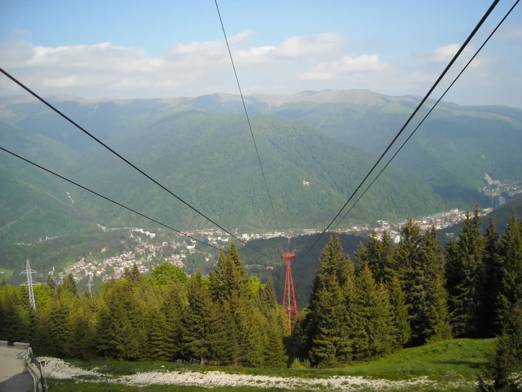
Sinaia
Useful for Poiana Stânii, Piatra Arsă, Cota 2000 and southern Bucegi access.
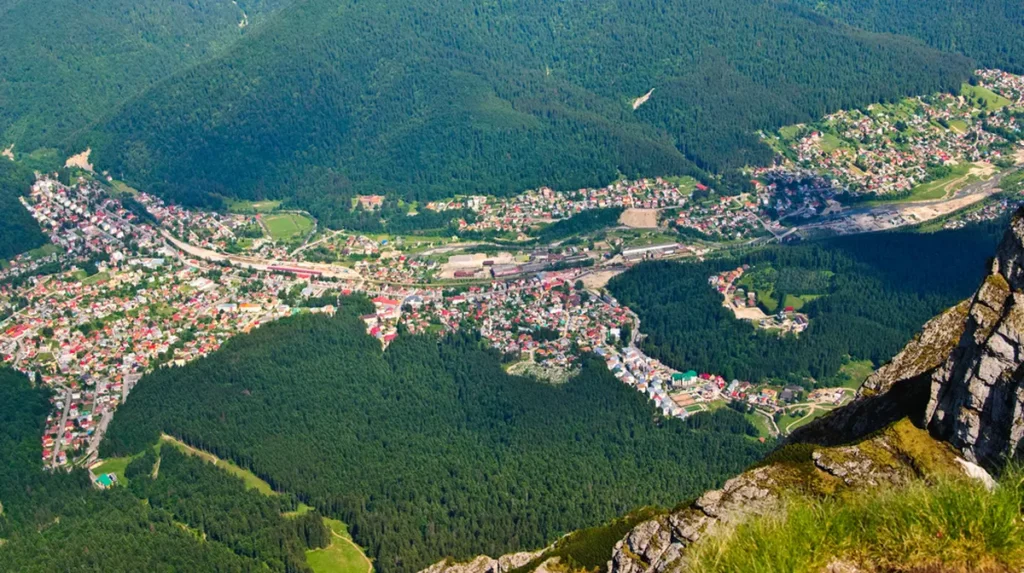
Bușteni
Direct access toward Urlătoarea, Diham, Jepii, Valea Cerbului and the Bucegi plateau.
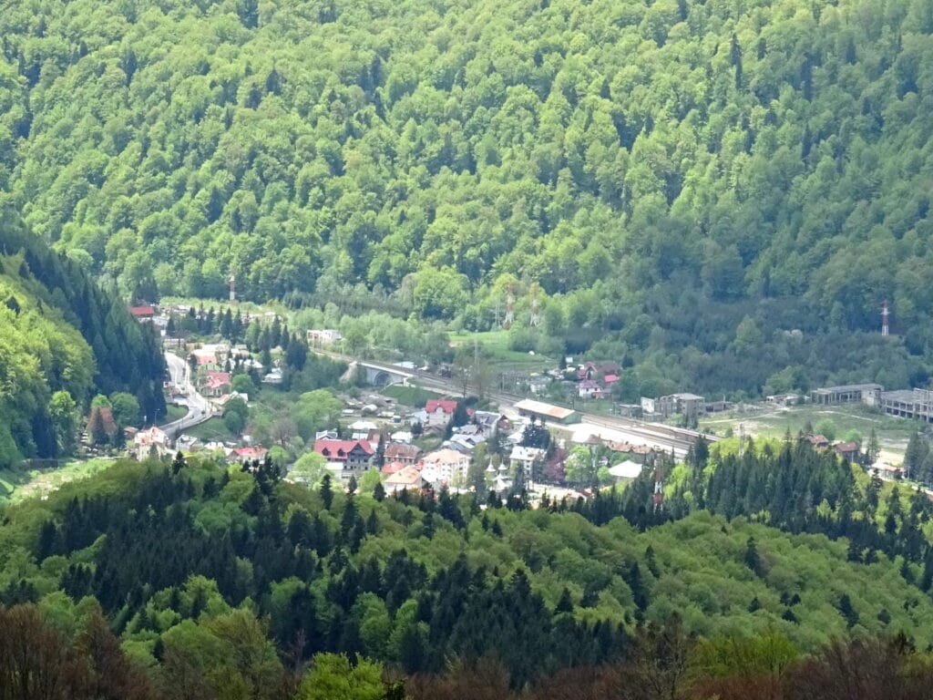
Azuga
A practical base for Sorica, Gârbova, Clăbucetul Taurului and routes toward Diham.

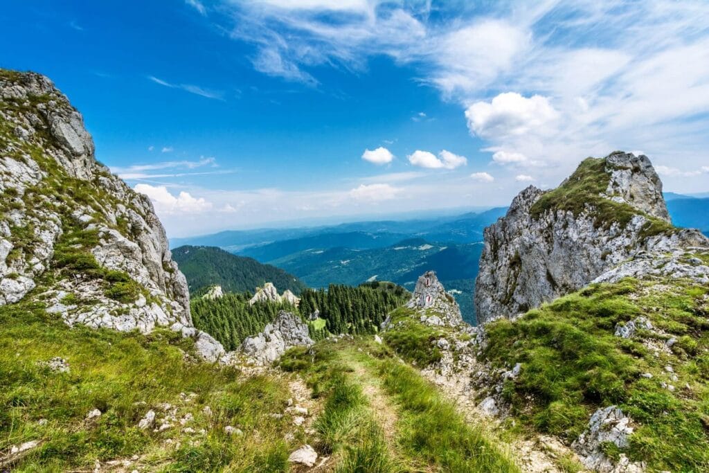
Piatra Mare
The Seven Ladders route starts at Dâmbul Morii, outside the four main resort centres.
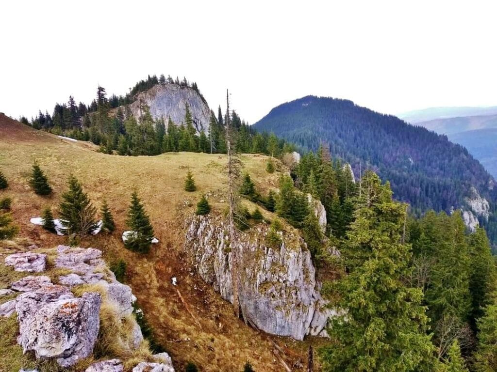
Bucegi plateau
Babele, the Sphinx, Caraiman and Omu sit in high, exposed terrain where weather can be very different from the valley.
Route comparison
18 hikes and route sections to compare
The times and seasonal notes below follow the route data used in the Romanian hub and have been checked against current official mountain-rescue tables where those routes are listed. Some cards are only segments of a longer official route; those are labelled so you do not mistake a partial time for a full day.
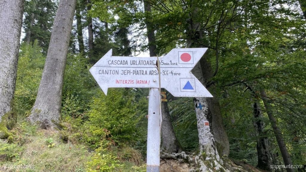
Bușteni – Urlătoarea Waterfall
Time45–60 min / one way
DifficultyLow
Markingred dot
A short forest approach, but add the walk from town and the return. Wet ground can change an otherwise easy outing.
See Bușteni hiking trailsBușteni – Gura Diham – Diham Hut
Time2.5–3 h
DifficultyLow
Markingblue triangle
The official time covers the route from Bușteni; reaching Gura Diham is not a separate five-minute approach.
See Bușteni hiking trailsBușteni – Valea Cerbului – Omu Peak
Time5.5–6.5 h / ascent
DifficultyModerate
Markingyellow stripe
Salvamont lists the Poiana Coștilei–Omu section as closed in winter. This is a long mountain day, not a quick summit walk.
Plan from BușteniJepii Mari – Piatra Arsă
Time3.5–4 h / ascent
DifficultyHigh
Markingblue triangle
The official table lists the route as closed in winter. Steep terrain and exposure make conditions more important than the published time.
See Bușteni hiking trailsJepii Mici – Caraiman – Babele
Time5–6 h on full route
DifficultyHigh
Markingblue cross
The Bușteni–Caraiman Hut section is closed in winter. The route includes steep, exposed sections and is not a beginner shortcut to the plateau.
Open the Jepii Mici guideBabele – Caraiman Cross – Șaua Șugarilor
Time2–2.5 h
DifficultyModerate
Markingred cross
The Caraiman summit–memorial section is listed as closed in winter. Wind and poor visibility can be serious even on the plateau.
Read the Caraiman Cross guideCaraiman Hut – Caraiman Cross
Time1–1.5 h
DifficultyModerate
Markingred dot
The official table lists this route as closed in winter. Check wind, visibility and the return before leaving the hut area.
Plan the Caraiman Cross visitSinaia – Poiana Stânii – Piatra Arsă
Time6–7 h on full route
DifficultyModerate
Markingblue stripe
The official 6–7 h route continues to Peștera Hotel. The Poiana Stânii–Piatra Arsă section is listed as closed in winter.
See Sinaia hiking trailsPiatra Arsă – Babele – Omu Peak
Timepart of a 5–6 h route
DifficultyModerate
Markingyellow stripe
Salvamont publishes the longer route, not a standalone time for this segment. Calculate the plateau section separately and keep a weather margin.
Open the Bucegi Mountains guidePoiana Stânii Regale / Royal Meadow
Timedepends on route
Difficultyroute-dependent
Markingcheck at trailhead
There are several ways to reach the Royal Meadow. Fix the actual trailhead first and do not confuse hiking access with nearby road access.
Compare Sinaia routesCota 2000 – Șaua Vârful cu Dor
Timeabout 15 min
DifficultyLow
Markingred triangle
Short does not mean risk-free: fog, strong wind and sudden cooling can make this exposed plateau segment uncomfortable or unsafe.
See Sinaia hiking trailsAzuga railway station – Grecului Peak – Diham Hut
Time2–2.5 h
DifficultyLow
Markingcheck official symbol
One of the useful routes for rail-based planning because the official route starts from the station area. Confirm the marking before setting off.
Open the Azuga guideDN1 km 135 – Sorica Ridge – upper gondola station
Time2–2.5 h
DifficultyLow
Markingcheck official symbol
Salvamont lists this Baiului route as open in both summer and winter, but never build the return solely around gondola operation.
Plan a stay in AzugaPredeal – Gârbova – Clăbucetul Taurului – Azuga
Timeabout 5–6 h
DifficultyStrenuous
Markingblue triangle
A linear day in the source guide. If you use it, confirm the current marking and your train or transfer back from Azuga before departure.
Open the Predeal guideDâmbul Morii – Seven Ladders – Piatra Mare Hut
Time3.5–4 h to hut
DifficultyStrenuous
Markingyellow stripe
Canyon opening, ticketing and access are separate from the hiking time. Check the operator before leaving for Dâmbul Morii.
Open the Seven Ladders guideBușteni – Poiana Izvoarelor – Omu Peak
Time6.5–7.5 h / ascent
DifficultyModerate
Markingred stripe
The Pichetul Roșu–Omu section is listed as closed in winter. The published time is for a serious ascent, not the full day including descent.
Plan from BușteniBușteni – Poiana Coștilei
Timenot published separately
Difficultynot published separately
Markingyellow stripe
Salvamont publishes the longer route toward Omu rather than a separate official time for this segment. Treat estimates from apps as secondary.
See Bușteni hiking trailsPoiana Țapului – Urlătoarea Waterfall
Time45–60 min / one way
DifficultyLow
Markingblue dot
A short forest route. If travelling by rail, confirm that your specific train stops at Poiana Țapului before building the day around it.
See Bușteni-area trailsGetting to the trail
Hiking without a car is realistic — but the station is not always the trailhead
Sinaia, Bușteni, Azuga and Predeal sit on the main railway corridor through the valley. That makes car-free hiking possible, but you still need to calculate the final walk, taxi, local transfer or cable-car connection.
Train-friendly bases
Choose the actual train first, then check how far its station is from the marked route. Do not assume every train stops at smaller stations such as Poiana Țapului.
Linear hikes
Routes that finish in another town can work well by rail, but only if you check the return timetable before starting and keep enough time for delays on the mountain.
Cable cars
Use cable cars as access tools, not as guaranteed rescue plans. Weather, maintenance, queues and operating hours can change your descent options.
Bucegi Natural Park
Use the park’s own map and trail information before going high
Bucegi Natural Park publishes an English trail page with distances, times, difficulty and downloadable GPX files for its theme trails, including Bușteni–Jepii Mici–Babele and Bușteni–Urlătoarea.
Checked in August 2026: the park currently lists an adult visitor ticket of 10 RON, valid for three months, available online or from rangers. Treat that as current information, not a permanent price.
Basic gear
Pack for the route and altitude, not for the weather in town
A sunny morning in Sinaia or Bușteni says little about wind, rain or temperature above 2,000 metres. Carry the layers and emergency items needed for the actual route.
Rain and sudden weather
A compact rain poncho can be useful as a backup, but check whether it works with your pack and in wind before relying on it.
Sun and plateau exposure
At altitude, exposure remains strong even when the air is cool. These category 3 hiking sunglasses are one product to compare; fit and lens choice still need to suit you.
Water
A 750 ml bottle may work for short outings, but do not treat that capacity as sufficient for long or hot routes. Plan water for the whole day.
First aid
A compact first-aid kit belongs in the pack only if you know what is inside and how to use it. It does not replace turning back early or calling 112.
Mountain safety
A difficulty label is not a live trail-status report
Salvamont Prahova publishes routes that are fully or partly closed in winter. Among the important examples are Jepii Mari, the Bușteni–Caraiman section of Jepii Mici, several approaches toward Omu and sections around Caraiman Cross.
Check the route table and warnings again on the day of the hike. Rain, ice, snow, fog, wind, damaged markings and a late start can make a normally manageable route a poor choice.
- Check the mountain-rescue route table and current warnings.
- Check the forecast for altitude, not only the resort town.
- Confirm the current trail marking and the real starting point.
- Set a turn-around time before you begin.
- Carry an offline map and keep following physical trail markings.
- Take rain protection, a warm layer and your own light source.
- Do not rely on a cable car or hut being available for your return.
- For an emergency in Romania, call 112 and give your route and last clear landmark.
Where to stay
Early starts are easier when you sleep near the right trailhead
For long mountain days, the practical base is usually the town that reduces morning transfers. Compare accommodation only after you have chosen the route.
Sources
What to check before departure
This is an editorial comparison hub, not a live trail-status service. These official sources should be checked again before a mountain day.
Official route times, difficulty and seasonal closures for the Prahova side of the Bucegi Mountains. Open official table.
Official route information for Azuga, Sorica, Gârbova and the Baiului Mountains. Open official table.
English trail information, GPX files, park map, wildlife guidance and visitor-ticket information. Open park trails.
Romania’s official meteorological warnings. Check mountain conditions and recent precipitation before departure. Open warnings.
For the Piatra Mare route, opening hours and canyon access are separate from hiking time. Open official canyon site.
For car-free hikes, verify your exact train and stop before departure rather than relying on a generic timetable. Check Infofer.
FAQ
Questions about hiking in Prahova Valley
What is a sensible first hike in the Prahova Valley?
For a short first outing, Salvamont lists Bușteni–Urlătoarea Waterfall at roughly 45–60 minutes one way with low difficulty. Conditions, wet ground and the walk to the trailhead still matter.
Can I hike Jepii Mici or Jepii Mari in winter?
Not as ordinary hiking routes. Salvamont Prahova lists Jepii Mari as closed in winter and the Bușteni–Caraiman section of Jepii Mici as closed in winter.
Which town is best as a hiking base?
Bușteni is especially practical for eastern Bucegi routes, Sinaia for the southern Bucegi and plateau access, Azuga for Baiului routes, and Predeal for routes toward Piatra Mare and the northern ridges. Choose the base after choosing the hike.
Can I go hiking here without a car?
Yes. Sinaia, Bușteni, Azuga and Predeal are on the main rail corridor, but the railway station is not always the trailhead. Check the final walk, local transfer or cable-car connection separately.
Is a GPX track enough for navigation?
No. Keep an offline map, but also follow current trail markings and signs. If the route becomes unclear, return to the last reliable marker rather than forcing a line from a phone screen.
Do I need a Bucegi Natural Park ticket?
For routes inside Bucegi Natural Park, check the park's current visitor rules. In August 2026 the official site lists a 10 RON adult visitor ticket valid for three months, available online or from rangers; confirm again before your hike.
Choose the route first, then check conditions again
Use the town guides to narrow the options, then confirm the mountain-rescue table, weather, transport and your return. A route that fits the map may still be the wrong route for today’s conditions.